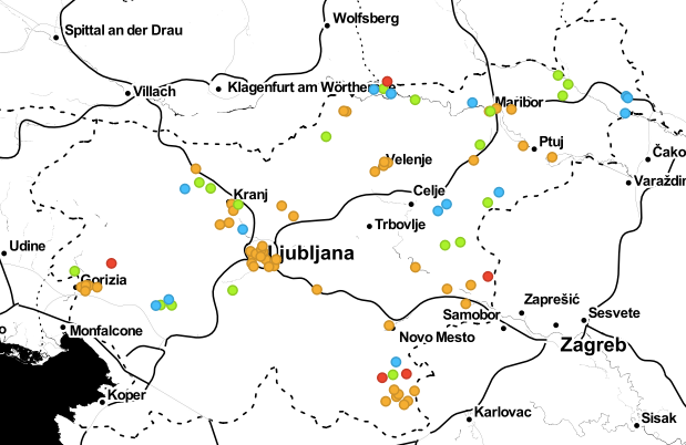
Map at a Glance
In our previous post, we told you about the Surname Challenge (in Slovene: Priimkoslovje), in which 56 schools from all over Slovenia are participating. But is it really from all around Slovenia? Well, more or less. The Primorska region is missing. We’ve checked this on the map above (and so can you).
Wonder how we created such a map? First, we took the table containing the data about the teachers who registered for the challenge. In the form, they were asked to provide their school address, but not also the name of the place – consequently, we needed to add that column ourselves, and it needed to be figured out from the address. (We’ll know for next time.)
From there on though, it was smooth sailing. We uploaded the mentioned table to Orange. In addition, we uploaded a table that contains data on all Slovenian residential areas, or in Slovene: Slovenska naselja. (A brand new table provided by the Datasets widget: it contains 6002 of the 6035 Slovenian residential areas. Some of them escaped us because Wikipedia, from which we retrieved them, did not have the right data for them.)

Workflow
In our next step, we merged the columns of the two tables using the Merge Data widget. For each row of the first table, the widget looked at the value in the column Place (in Slovene: “Kraj”), and found the row of the second table that has the same data in the column Residential Area (“naselje”) - since the column with the name of the place/residential area does not look the same in both tables. This has produced a table which, in addition to the information about the registered school, also contains the coordinates of the place where the school is located.
An annoying detail: in Slovenia, there are 6 035 residential areas with 5 271 different names. As you can probably tell, some names appear more than once. Since in thus case, the Merge Data cannot make a decision, we used the Unique widget to keep only one of the repeated names - and kept our fingers crossed that it was the right one, or that none of the participating schools is located in any of these places. To do this correctly, the school data should also include the municipalities - but it doesn’t.
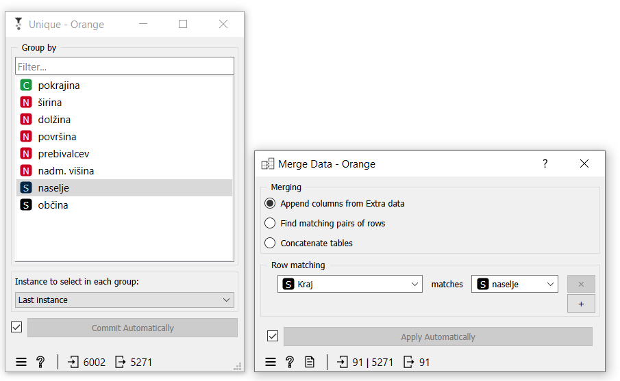
Eliminating duplicate place names and merging data
We then pinned the map, producing the image at the top of this post. Voila!